


Garmin, a leading name in marine navigation technology, has introduced the GPSMAP 8412xsv chartplotter, a powerful and feature-rich device for boaters and anglers. One of its standout features is relief shading, a revolutionary technology that enhances the navigational experience by providing detailed and realistic underwater topography. In this article, we will explore the remarkable capabilities of the Garmin GPSMAP 8412xsv and how relief shading, in conjunction with Navionics Vision Plus charts, elevates marine navigation to new heights.
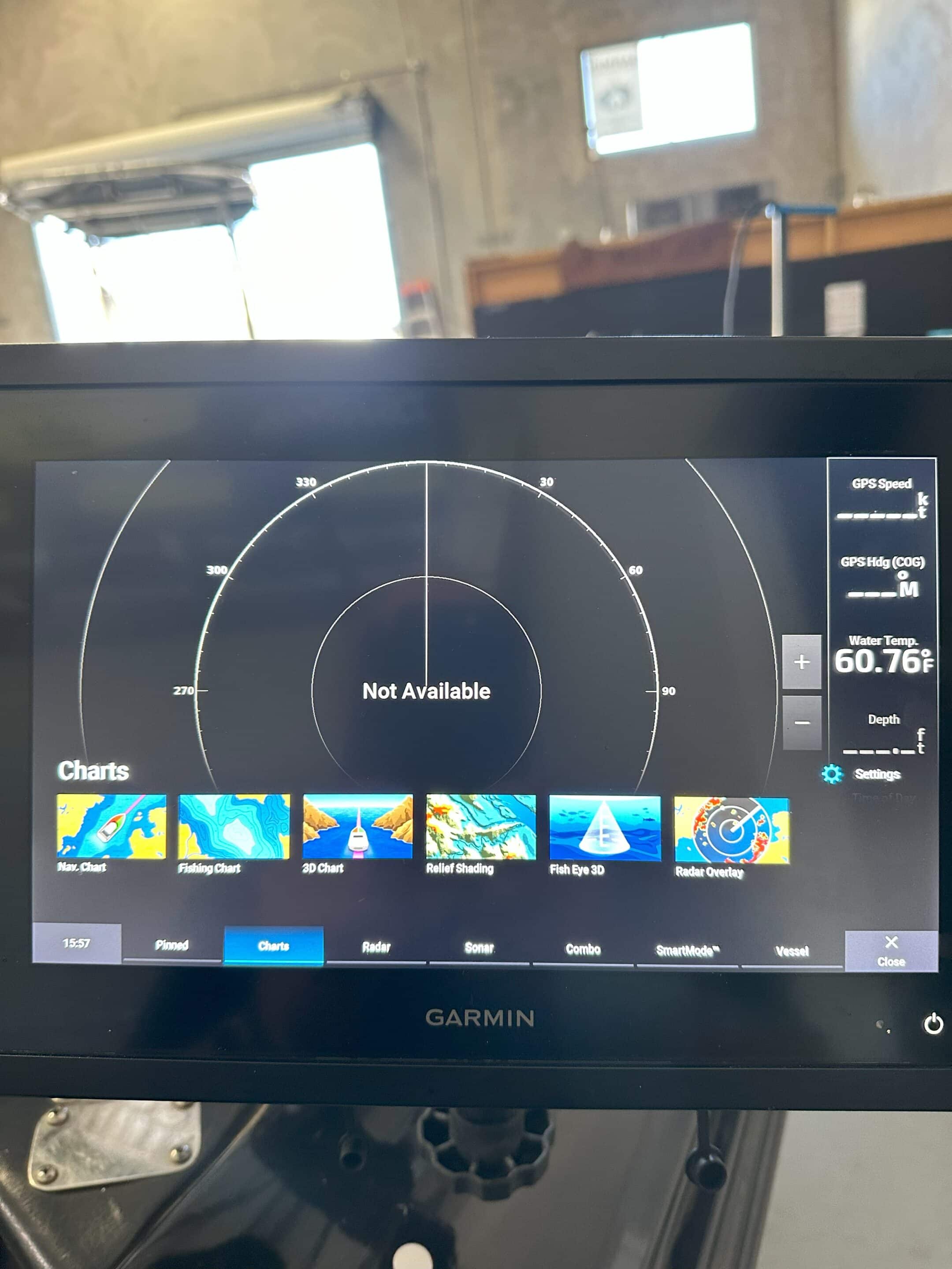
The Garmin GPSMAP 8412xsv is a cutting-edge chartplotter designed specifically for marine environments. Its impressive 12-inch touchscreen display offers exceptional clarity and visibility in any lighting conditions. With a powerful processor and high-sensitivity GPS, it provides accurate positioning, tracking, and route planning capabilities.
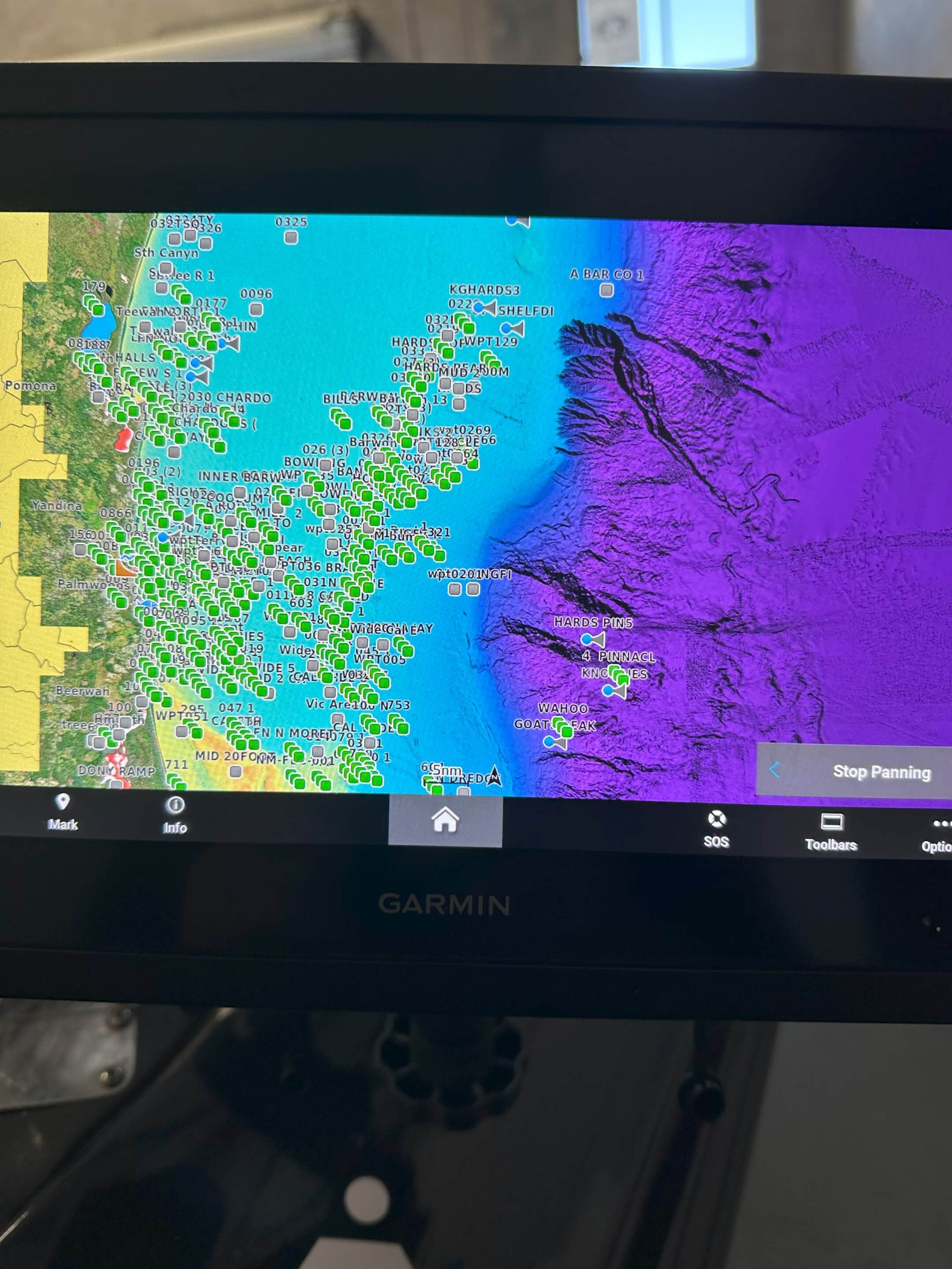
Relief shading, a revolutionary technology integrated into the Garmin GPSMAP 8412xsv, adds a new dimension to marine navigation. By seamlessly blending bathymetric data with the chartplotter’s display, it creates detailed and lifelike representations of underwater topography. This enables boaters to navigate with increased situational awareness and precise accuracy.
When paired with Navionics Vision Plus charts, the Garmin GPSMAP 8412xsv reaches its full potential. Navionics Vision Plus charts provide extensive coverage of coastal waters and inland lakes, delivering accurate mapping data that seamlessly integrates with relief shading technology.
The combination of relief shading and Navionics Vision Plus charts enhances situational awareness for boaters. Detailed contours, shadows, and depth gradients allow users to quickly identify underwater features, potential hazards, and changes in depth. This invaluable information aids in safer navigation, especially in unfamiliar waters.
Relief shading, in conjunction with Navionics Vision Plus charts, provides boaters with precise depth perception. By presenting depth information through realistic representations of depth gradients, the Garmin GPSMAP 8412xsv allows users to easily interpret and navigate depths, ensuring optimal route planning and avoidance of shallow areas.
Anglers will find relief shading invaluable for identifying prime fishing spots. The lifelike representation of underwater features, such as drop-offs, reefs, and submerged structures, assists anglers in locating optimal fishing locations with confidence. This feature maximizes their chances of a successful and rewarding fishing experience.
The Garmin GPSMAP 8412xsv seamlessly integrates with other Garmin marine devices and sensors, creating a comprehensive navigation system. Its user-friendly interface provides easy access to relief shading and other advanced features. With customizable data fields, split-screen display options, and intuitive controls, users can personalize the chartplotter to suit their specific preferences and needs.
The Garmin GPSMAP 8412xsv offers real-time weather updates and radar integration, further enhancing its capabilities. Boaters can monitor weather conditions, receive alerts, and make informed decisions to ensure safety and optimize their navigation routes.
With built-in Wi-Fi and Bluetooth connectivity, the Garmin GPSMAP 8412xsv allows seamless wireless communication with compatible devices. Users can stream data, receive smart notifications, and access the Garmin ActiveCaptain app for additional features such as marina information, community updates and lots more.
For more information about relief shading or information on Garmin GPSMAP 8412xsv give Rob a call on 0427 590 995 or head to our webiste at www.scmarinedoc.com.au.

All-seeing live sonar from Garmin is the most unique and innovative sonar on the water. This state-of-the-art sonar technology gives you the ability to see
The Garmin Force Kraken Trolling Motor has quickly become a top choice for serious anglers and boating enthusiasts due to its advanced technology, high efficiency,

Surrender to the sound with Fusion Apollo coaxial marine speakers and subwoofers, and enjoy immersive, high-fidelity audio and bass on the water. Complete the look