


Garmin is a renowned brand in the marine electronics industry, offering a wide range of chartplotters to cater to the needs of boaters and anglers. Among their popular offerings are the Echomap chartplotters and GPSMAP chartplotters. In this article, we will explore the key differences between these two product lines, helping you make an informed decision when choosing the right chartplotter for your marine adventures.
Design and Display:
One of the noticeable differences between the Garmin Echomap chartplotters and GPSMAP chartplotters lies in their design and display capabilities. The Echomap series features a user-friendly interface with a touchscreen display that is intuitive and easy to navigate. The display sizes typically range from 5 to 12 inches, offering a clear and bright view of charts, maps, and other navigational data.
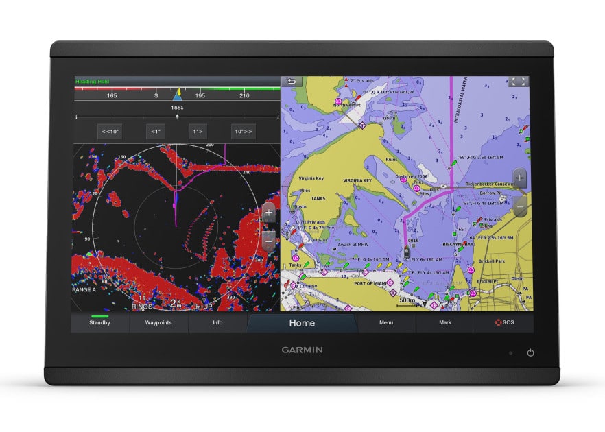
On the other hand, GPSMAP chartplotters come with larger display options, ranging from 7 to 24 inches, providing a more expansive and detailed view. These displays often utilize higher resolutions, offering sharper and more vibrant visuals. While both series offer sunlight-readable screens, the larger displays of the GPSMAP series are particularly beneficial for boaters who require a broader and more immersive viewing experience.
Sonar Capabilities:
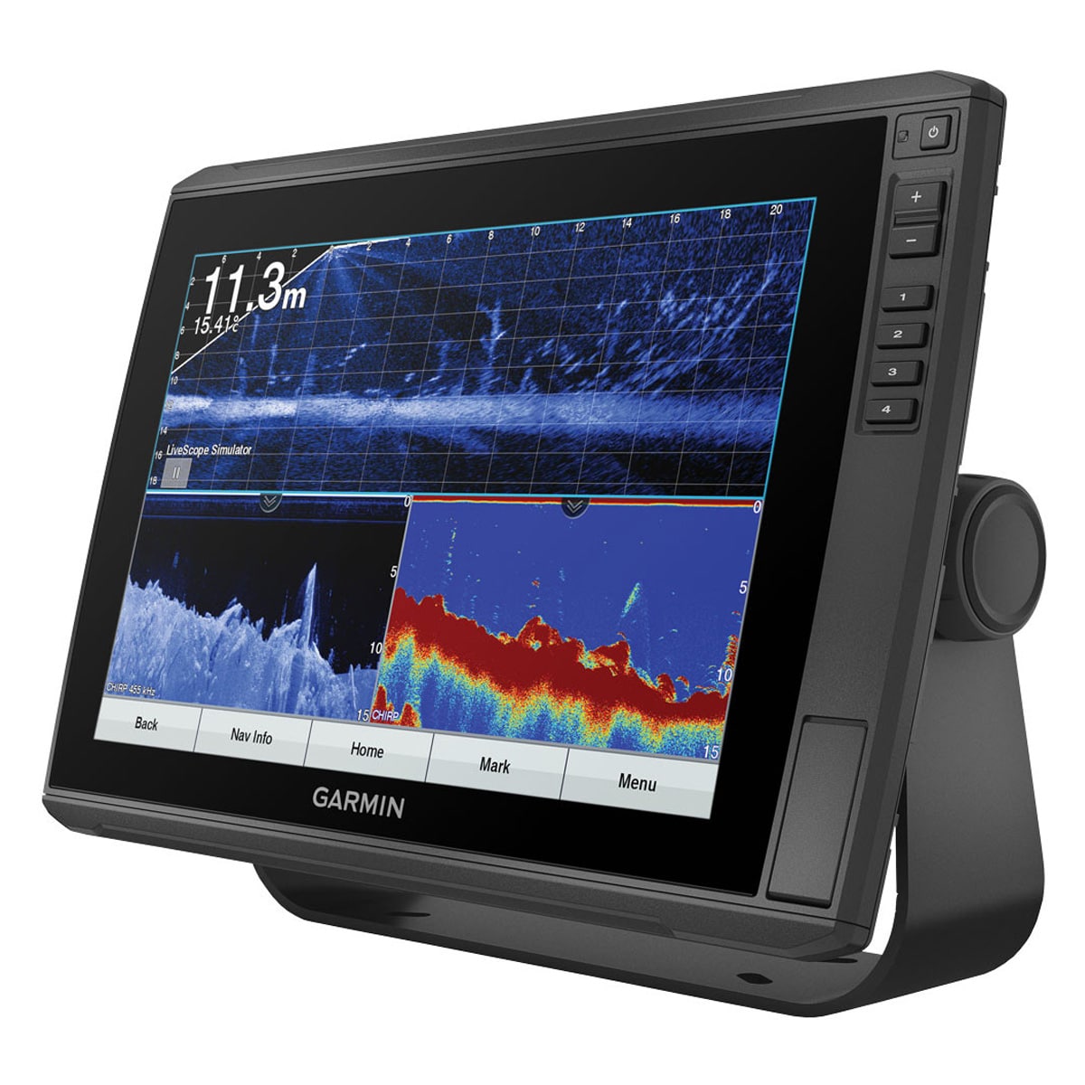
When it comes to sonar capabilities, both the Echomap and GPSMAP chartplotters offer a range of options to suit different needs. The Echomap series typically includes models with built-in traditional sonar and CHIRP sonar capabilities. These sonar technologies enable users to detect fish, structure, and the underwater landscape with clarity and accuracy.
In comparison, the GPSMAP series often includes models with more advanced sonar technologies such as CHIRP ClearVü and CHIRP SideVü. These imaging sonars provide anglers with enhanced detail and imaging of the underwater environment. Additionally, certain models within the GPSMAP series may also offer features like Panoptix LiveScope, which provides real-time scanning sonar imagery.
Mapping Features:
Both the Echomap and GPSMAP chartplotters excel in terms of mapping capabilities, providing detailed and comprehensive coverage. The Echomap series typically comes preloaded with BlueChart g3 coastal charts and LakeVü g3 inland maps. These maps offer bathymetric contours, depth range shading, and spot soundings, aiding in navigation and fishing across coastal and inland waterways.
The GPSMAP series often includes built-in worldwide basemap coverage or BlueChart g3 coastal charts, depending on the specific model. Some higher-end GPSMAP models offer expanded mapping options and may include additional features like Auto Guidance, which provides suggested routes based on desired depths and navigational aids.
Connectivity and Networking:
Connectivity options also differ between the Echomap and GPSMAP chartplotters. While both series support NMEA 2000 connectivity for integration with compatible marine electronics, the GPSMAP series generally offers more extensive networking capabilities. These chartplotters often have multiple NMEA 2000 ports, allowing for seamless integration with various devices such as autopilots, radar systems, and AIS receivers.
Additionally, certain models within the GPSMAP series may offer wireless connectivity, enabling access to features like smart notifications, software updates, and compatibility with mobile apps such as ActiveCaptain. These wireless capabilities provide users with real-time information, updates, and enhanced functionality for a more connected and convenient boating experience.
Choosing between Garmin Echomap and GPSMAP chartplotters ultimately depends on your specific needs and preferences. The Echomap series offers user-friendly interfaces, reliable sonar capabilities, and comprehensive mapping options. On the other hand, the GPSMAP series provides larger and higher-resolution displays, advanced sonar technologies, expanded mapping features, and enhanced connectivity options. By understanding these differences, you can make an informed decision and select the chartplotter that best suits your boating and angling requirements, ensuring a more enjoyable and productive time on the water.
Whatever your needs GARMIN Marine have a chartplotter just for you. We realise that there is a lot information, new technologies and range to pick from if you are interested in purchasing a ECHOMAP or GPSMAP but not sure what is the right Garmin chartplotter for you, please call us. Rob will talk you through evrything that you may need. Call now 0427 590 995.
That’s a wrap for Rayburn Reservoir. The Division 2 slate has more renowned fisheries, perhaps why it’s drawn an almost full complement of 230 anglers.
Zipwake – Dynamic Trim Control System SCMED has partnered with AMI to be able to stock Zipwake Series S complete kits. If you are interested

The ultimate Livescope bundle is here. We can’t make it any easier than this, just decide on your Garmin fishfinder screen and it comes with everything you